
The fourth section of the Texas Coast Bikerafting Route (TCBR) features some great lesser utilized beaches separated by multiple river mouth crossings.
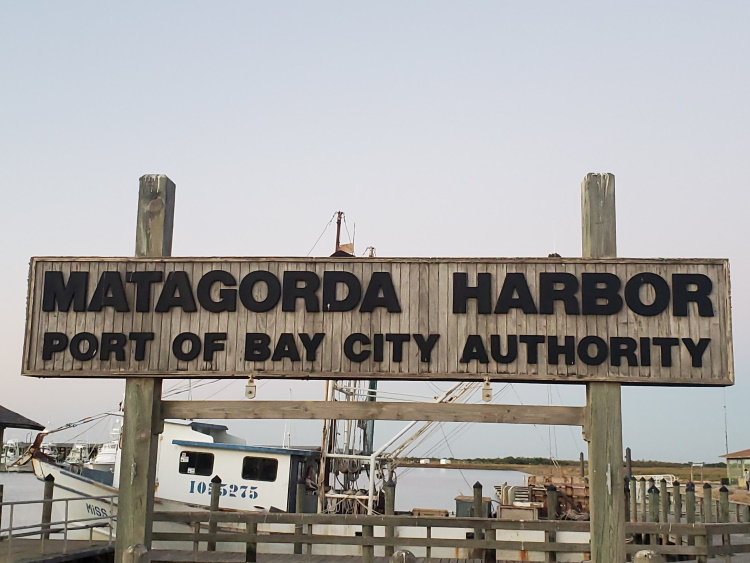
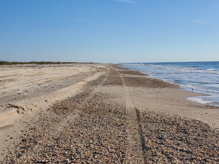
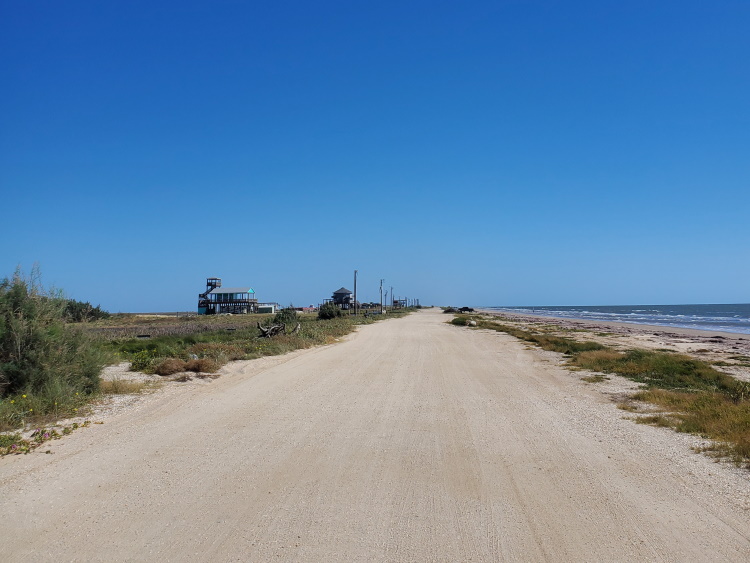
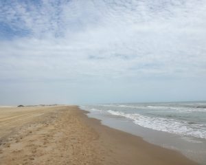
The previous section left off after crossing the mouth of the Colorado River and arriving at Matagorda Beach. The actual town of Matagorda, with restaurants, a coffee shop, and a couple of stores, lies about 7 miles inland and can be reached by an out and back ride from here. Continuing on, Matagorda Beach runs for about 22 miles to the next water crossing at Mitchell’s Cut near the mouth of Caney Creek. Access to the beach is only from the southwestern end and cars are allowed on the beach so you will likely see folks near the beginning with fewer as you go on. The beach here was generally nice with some intermixed heavily shelled sections. Near the end, the beach flattens out and is great for riding and camping is allowed anywhere along the beach. The crossing at Mitchell’s Cut was quick and easy after following the beach around to the narrowest part of the pass.
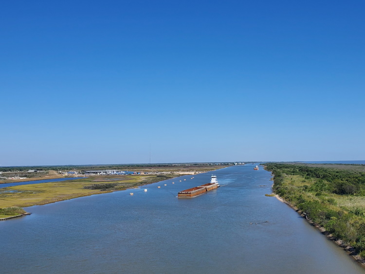
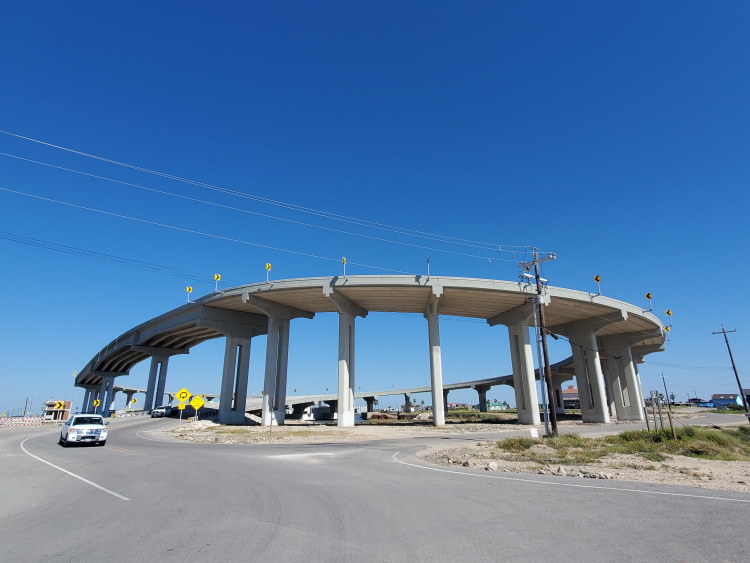
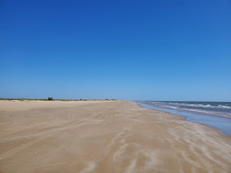
After crossing at Mitchell’s Cut you will be on the southwestern end of Sargent Beach. You’ll likely run into some fishermen here on the Sargent side as this cut is a popular and accessible site for fishing. About a mile and a half up the beach is the West Moring Dock Park and Sargent Public Boat Ramp. Here you will want to hop on Revement Rd to continue onward as there is a seawall that will make the beach unrideable. Another mile down the road you will encounter the Sargent Beach Bridge. This massive corkscrew bridge which replaced an old swing bridge over the intracoastal waterway is impossible to miss. If you want to go into the small town of Sargent on the mainland for supplies or otherwise, that is the way to go. Continuing onward on Canal Rd takes you through the narrow strip of beach homes before returning to the beach about 2 miles later. Sargent Beach continues on for about 10 miles to the mouth of the San Bernard River. The beach was generally good for riding with some heavily shelled areas. The crossing at the mouth of the river here is similar to the previous and following the beach around to the narrowest point makes for a quick and easy crossing.
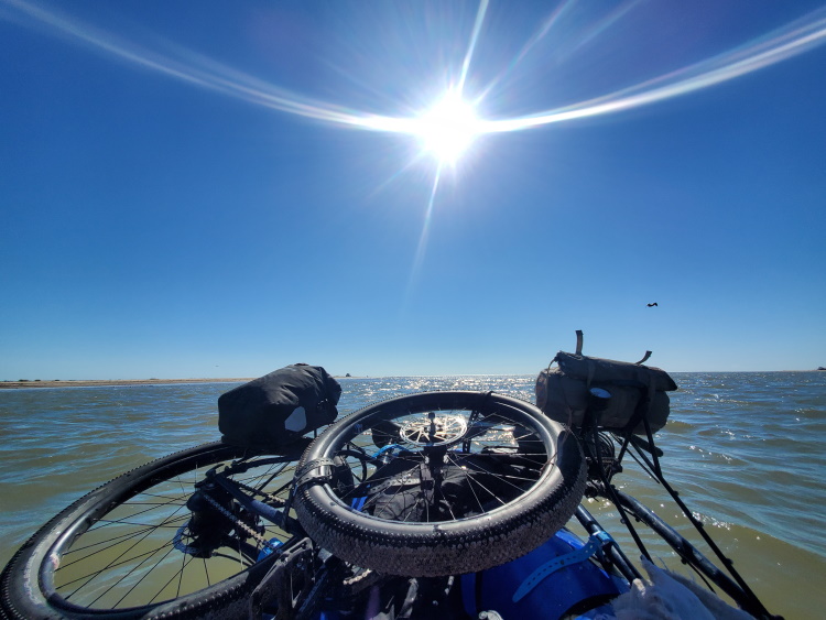
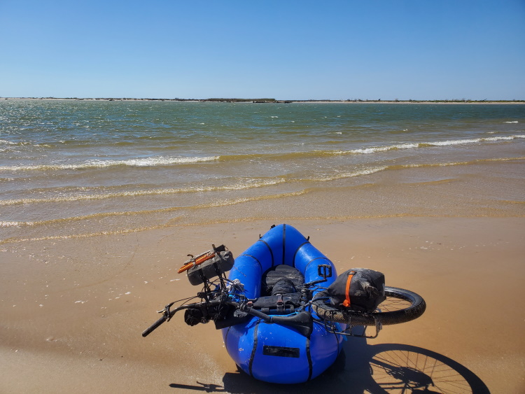
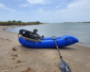
After crossing the mouth of the San Bernard River, you’re on an island that I didn’t find any info about. The beach here runs about 4 miles to the mouth of the Brazos River. The back side of the island faces the intracoastal waterway and looking at maps, it appears that this waterway previously cut through the interior of the island and much of the interior of the island is covered in water. The island does not appear to be inhabited and I did not see any internal roads. The beach was unexpectedly covered with old logs, but they did not present any issues with travel on the beach at low tide. At high tide, the log jams could make sections impassible. This is the last remote section for quite a ways. If you enjoy the remote sections, perhaps stay a bit longer, but if you’re ready for some beach town vibes and the amenities they offer, it’s time to cross the mouth of the Brazos River which will put you on Bryan Beach. This crossing is similar to the last two water crossings with an important distinction. It is the last where a raft is required as bridges and a ferry are available over the course of the remainder of the route.
Towns and Resupply Areas
The town of Matagorda can be reached at the beginning of this section by riding about 7 miles inland on FM 2031 (Beach Rd) from Matagorda Beach. The town of Sargent can be reached via the Sargent Beach corkscrew bridge. The town of Freeport is just after this section.
Water Sources
Water is available at Matagorda Beach Park, the town of Sargent, and then after this section in either Quintana (at the county park) or the city of Freeport.
Camping Areas and Lodging
Camping is allowed on most of the beaches with the exception being the short populated stretch in Sargent where there is a seawall. Hotels are available near the beginning of the section in Matagorda, in the town of Sargent, and after this section in the Freeport and Surfside Beach areas.
- Part 1: Intro
- Part 2: Terrain and Environment
- Part 3: Rio Grande to Mansfield Channel
- Part 4: Mansfield Channel to Port Aransas
- Part 5: Port Aransas to Matagorda Beach
- Part 6: Matagorda Beach to Bryan Beach (You are here)
- Part 7: Bryan Beach to Galveston
- Part 8: Galveston to Sea Rim State Park
Notice: Outdoor activities such as those described on this site are inherently dangerous. Effort has been put forth to present factual information but no guarantee is made that it is complete or represents current conditions. You assume all risk with any use of the information on this site.

Love following along the journey