The second section of the Texas Coast Bikerafting Route (TCBR) features the natural expanse of Padre Island National Seashore followed by Mustang Island with the beach town of Port Aransas.
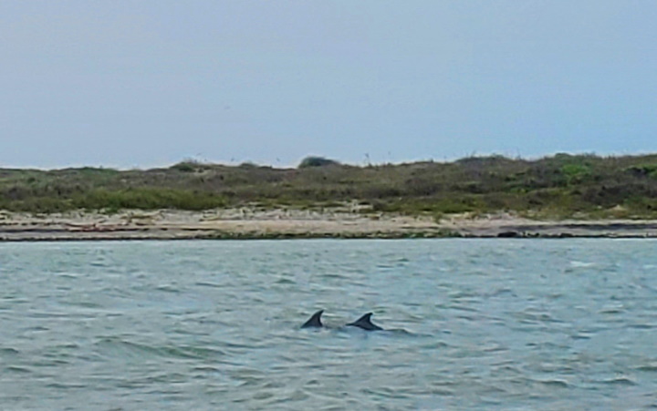
The previous section left off at the Port Mansfield Channel heading north. This is a man made shipping channel that cuts through Padre Island. There is no dry way to cross here. To make this crossing, I rode to the jetty on the beach and then traveled inward a short ways to get behind it to a suitable sandy launch point. There was a bit of bike pushing to get off the beach and behind through the deep, soft sand, but nothing more than a couple minutes. The channel is only about 500 ft wide so it’s a quick crossing, but one should be sure there are no boats making their way through at the time. As I was crossing, I spotted a pod of dolphins in the channel.
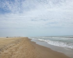
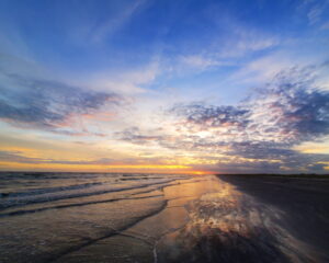
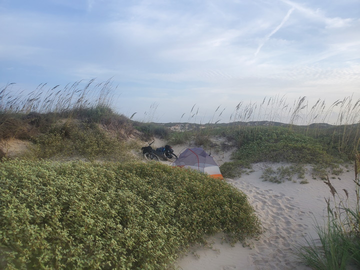
Once on the other side, making my way back to the beach I was on the Padre Island National Seashore. Padre Island National Seashore is a national park that preserves over 130,000 acres of beach, dunes, and wetlands and is known for its unique ecosystem and diverse wildlife. The park is located on the longest undeveloped barrier island in the world, and it’s a nesting ground for sea turtles and a habitat for a variety of endangered species. This section of beach is about 65 miles long and entry and camping is allowed, but requires a pass for a fee which can be obtained online. There are mile markers about every 5 miles along the beach counting down to the beach entrance. The one at mile 45 is festooned with many hard hats which have washed ashore. I don’t know why so many have washed ashore at this particular section of beach, but you can expect to see some other strange accumulations along the coast. Two sections of the beach are known as “Big Shell” and “Little Shell” which interrupt the soft sandy beaches with enormous amounts of shells. I camped not far from mile marker 45 and can say that it is a great place for viewing the night sky. It’s one of the darkest areas from contaminating light sources on the coast of the contiguous United States.
Mustang Island is the next barrier island and is about 18 miles long. It is separated from Padre Island by the Packery Channel. One bridge connects the two islands via TX-361. I suppose one could go back behind the jetty and cross the channel by raft, but you would be right by that bridge so I don’t see any reason to do that. It is a busy highway so caution on the bridge is warranted. One can continue along the highway which runs parallel to the beach or return to riding on the beach at any of several beach access points (the first is the first road on the right, Zahn Rd). Mustang Island State Park is not far down. It offers beach camping for a fee and is also a popular day use beach. It has typical amenities you would expect for a TX state park including warm showers.
Port Aransas is located on the north end of Mustang Island. It is a small laid back, touristy town popular with beach goers and fisherman alike. This can be a nice place for a rest, resupply, and to enjoy the town as this is the last of civilization until one reaches Matagorda Beach, about 90 miles and 5 water crossings later (the first crossing will be by a private ferry).
Towns and Resupply Areas
The developed area between Padre National Seashore and Mustang Island state park has stores and restaurants. Port Aransas also has a variety of stores and restaurants. You’ll want to make sure to have plenty of supplies for the next leg of the journey.
Water Sources
Malaquite Welcome Center will be the first water source at about 65 miles. It also has public cold water showers (only the outside ones were available due to remodeling last time I was there). Water can also be sourced at the developed area of Corpus Christi, Mustang Island State Park, or in the town of Port Aransas. When leaving Port Aransas to San Jose Island, it will be about 90 miles and 4 more water crossings to the next water source at Matagorda Beach, and adequate water must be carried.
Camping Areas and Lodging
Padre Island National Park allows camping on the beach for a small fee and also has fee campsites at its campgrounds. Mustang Island State Park allows camping on the beach for a fee. Camping on the beach is allowed for free on Port Aransas Beach. Hotels are available in the developed area at the north end of Padre Island and south end of Mustang Island that is part of Corpus Christi and also on the north end of Mustang Island in Port Aransas.
- Part 1: Intro
- Part 2: Terrain and Environment
- Part 3: Rio Grande to Mansfield Channel
- Part 4: Mansfield Channel to Port Aransas (You are here)
- Part 5: Port Aransas to Matagorda Beach
- Part 6: Matagorda Beach to Bryan Beach
- Part 7: Bryan Beach to Galveston
- Part 8: Galveston to Sea Rim State Park
Notice: Outdoor activities such as those described on this site are inherently dangerous. Effort has been put forth to present factual information but no guarantee is made that it is complete or represents current conditions. You assume all risk with any use of the information on this site.